If you are a Project Fi user, in Google maps is one that you will want to get on your phone. The reason? You can now have the app show you were Open Wi-Fi compatible hotspots are near you so you can securely connect your Nexus device to them without any configuring on your part. The points are user generated and provided to you within the Maps app. As Fi users know, Open Wi-Fi is built into Nexus devices and Fi leverages it to connect you automatically to hotspots that meet Google’s criteria. The connections are secure thanks to them being an encrypted VPN connection and when you go into a location with an approved network, your phone will connect automatically for you. I wrote on this feature back in November and if you aren’t familiar with this aspect of Fi, give it a read to get caught up.
When you open up Google Maps, you will now have the ability to show these hotspots thanks to an option on the menu. But, to do that, you need to add this My Map to your Google Maps. You can turn it off again just by tapping the option in the menu. Once enabled, you will see pin drops for locations that have Open Wi-Fi. If you tap on those pins, you can see the name of the business and other information that you would get in Google Maps. While I don’t know if I would necessarily change my dining option based on this information, it’s good to know that you can quickly and easily see them if you need Wi-Fi.
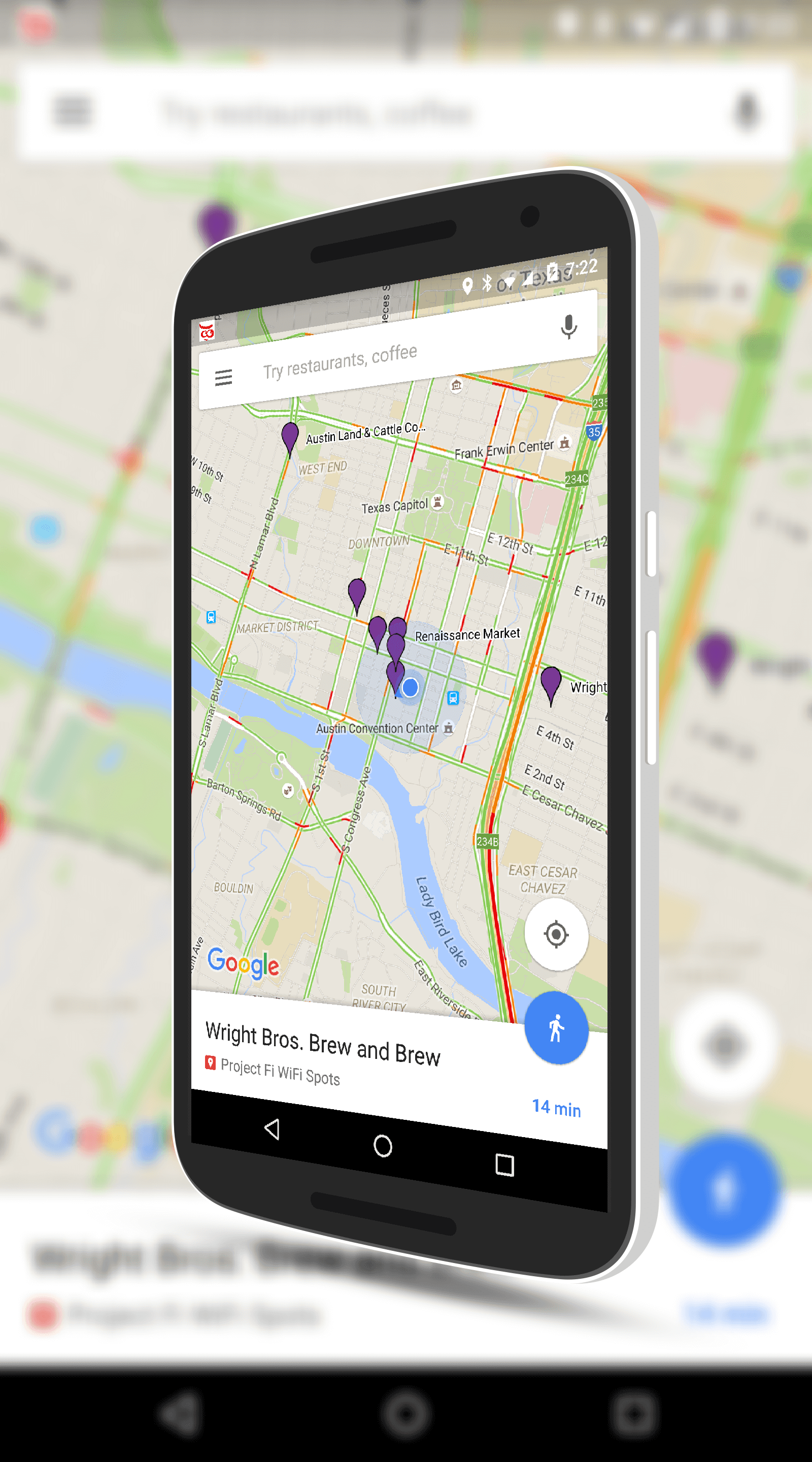
Project Fi Open Wi-Fi Spots in Google Maps
If you are a Fi users and you use this feature, almost immediately you will notice that some spots you have connected to via Open Wi-Fi are not there. This is because it is user generated so as users add hotspot it will be populated on the map. In my home town of Denver, there are quite a few still missing and I suspect that will improve over time.
Where is that menu option? I don’t see anything on Google Maps mentioning Fi
Ditto, no wifi hotspot location on my maps, I just updated and still none. Nexus 6 on Marshmallow
While on your phone, tap the “add this my maps” link.